Contour Maps
Drone Photogrammetry Contour Maps
Contour Maps

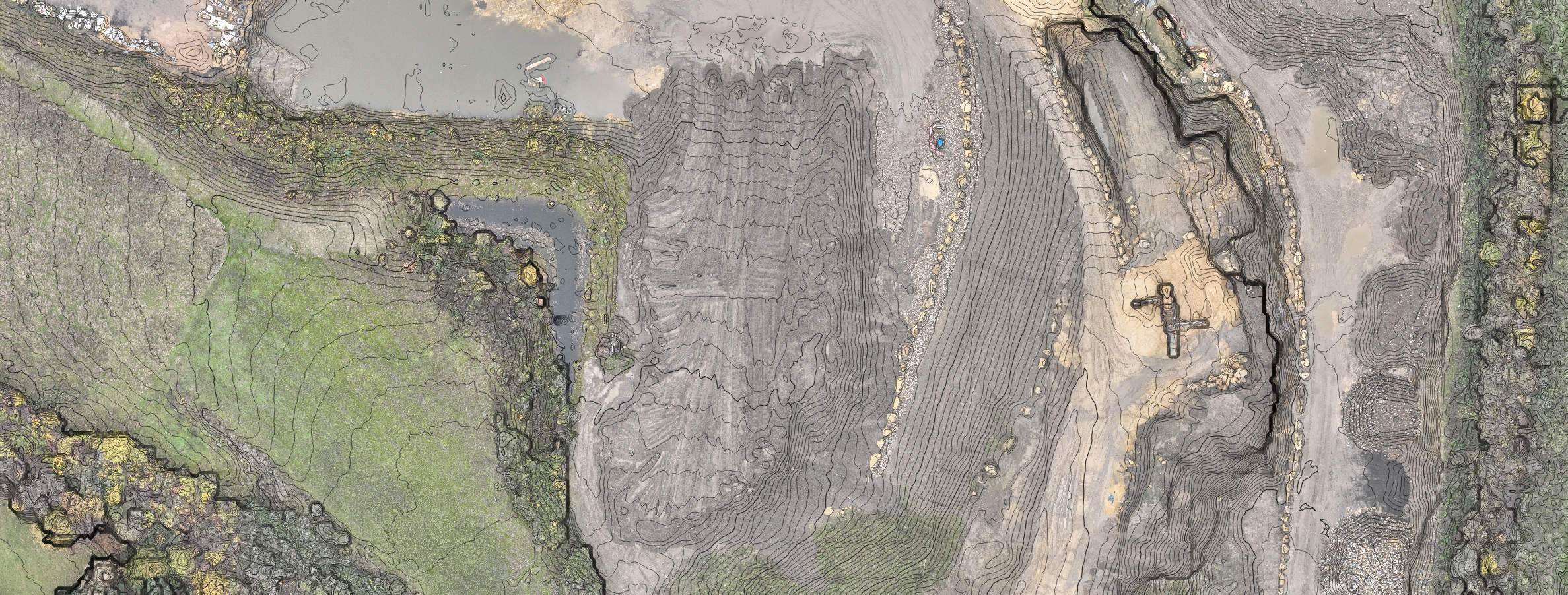
A contour map is a two-dimensional representation of the site's topography, which uses contour lines to represent changes in elevation. Contour maps are created using the same data as DSMs, but with additional processing to create a simplified view of the site's topography.
One of the primary benefits of contour maps is that they provide an easy-to-understand visual representation of the site's topography. This information can be used to identify potential issues or hazards that may be difficult to detect from other outputs, such as areas of the site that are prone to flooding or erosion. This information can be used to inform the design and construction of infrastructure and buildings on the site, to ensure that they are built to withstand potential natural hazards.
Contour maps can also be used to plan and optimise the placement of infrastructure and buildings on the site. For example, construction professionals can use contour maps to identify areas of the site that are suitable for building foundations or to plan the placement of roads and other infrastructure. Contour maps can also be used to identify areas of the site that are unsuitable for development, such as areas with steep slopes or other features that make construction difficult or unsafe.
Another important use of contour maps is in the planning of environmental mitigation measures. Construction activities can have a significant impact on the natural environment, and contour maps can be used to identify areas of the site that are particularly sensitive or ecologically important. This information can be used to plan and implement measures to protect these areas during construction activities, minimising the impact of construction on the natural environment.
Contour maps can also be used to monitor changes to the site over time. For example, construction professionals can use contour maps taken at different stages of the project to identify areas where erosion or other changes to the topography have occurred. This information can be used to plan and implement measures to mitigate the impact of these changes on the site.
Overall, contour maps are a powerful tool for construction professionals, providing a simplified but informative view of the site's topography. By using contour maps to plan, monitor, and optimise construction activities, construction professionals can ensure that their projects are executed safely, efficiently, and in an environmentally responsible manner.